Winter Storm Watch Issued for Central Minnesota
UNDATED (WJON News) -- The National Weather Service has issued a Winter Storm Watch for a large part of Minnesota.
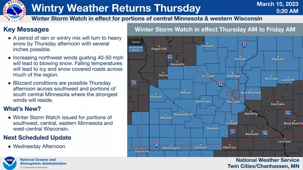
The watch will be in effect from Thursday morning through Friday morning.
We’ll start out with rain, but quickly changeover to snow.
Heavy snow and blowing snow are possible. Total snow accumulations of four to seven inches and ice accumulations of a light glaze are possible.

Winds could gust as high as 40 mph.
Plan on slippery road conditions.

Widespread blowing snow could significantly reduce visibility. The hazardous conditions could impact the morning and evening commutes.
So far this season, St. Cloud has officially had 74.0 inches of snow. We need just another 1 1/2 inches of snow to move into the Top 5 snowiest seasons on record in St. Cloud.
For just the month of March, St. Cloud has officially had 13.7 inches of snow so far. We need just another 2 1/2 inches of snow to move into the Top 10 snowiest Marches on record in St. Cloud.
Our temperatures will resemble mid-January rather than mid-March for the weekend.
READ RELATED ARTICLES
- Lincoln Center Frustrations
- St. Cloud Woman's Guilty Plea on Drug Charges
- Big Lake Woman Charged in Feed Our Children Fraud Scheme
- 6th Snowiest Season on Record in St. Cloud
- Crossroads Center's Mortgage is Due in April
Presidential/Vice Presidential Visits to St. Cloud
More From AM 1240 WJON