

Update: Flood Watch Cancelled for Central Minnesota
UNDATED (WJON News) -- A Flood Watch was issued on Tuesday for several counties in central Minnesota.
Update: The National Weather Service has now cancelled the Flood Watch on Wednesday morning. As of 7:00 a.m., St. Cloud has officially received 0.27 of an inch of rain.

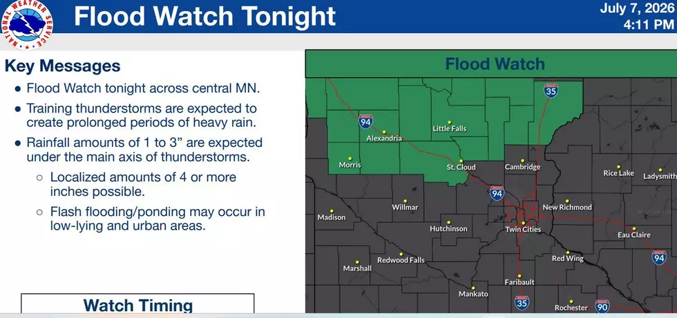
The National Weather Service says the Flood Watch will be in effect from 10:00 p.m. on Tuesday until Wednesday morning.
Excessive runoff may result in flooding of rivers, creeks, streams, and other low-lying, flood-prone areas.
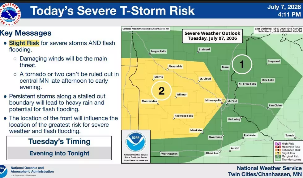
Training thunderstorms will be possible north of a stalled-out boundary Tuesday night into Wednesday morning, posing a threat of heavy rain and flash flooding.
St. Cloud officially received just over a half-inch of rain at Sky Central Airport on Monday night. We've had 1.74 inches of rain so far in July, which is an inch above normal. We've had 5.36 inches of rain in the summer months of June and July so far, which is nearly an inch above normal.
However, some parts of the St. Cloud metro have had much more rain than the official measurement. For example, the downtown St. Cloud area received over 3 1/2 inches just on Saturday, July 4th alone, which caused significant street flooding.
Wednesday has been upgraded to a Slight Risk (2/5) for areas of western Wisconsin and southeastern Minnesota. The primary threats are gusty winds and hail, alongside heavy rain.
Brantley Gilbert 2026
Gallery Credit: Paul Habstritt
More From AM 1240 WJON