Heavy Snowfall Expected As Winter Storms Hit Minnesota Again
UNDATED (WJON News) — It's no joke: the first of two rounds of wintry weather will arrive on April Fool's Day.

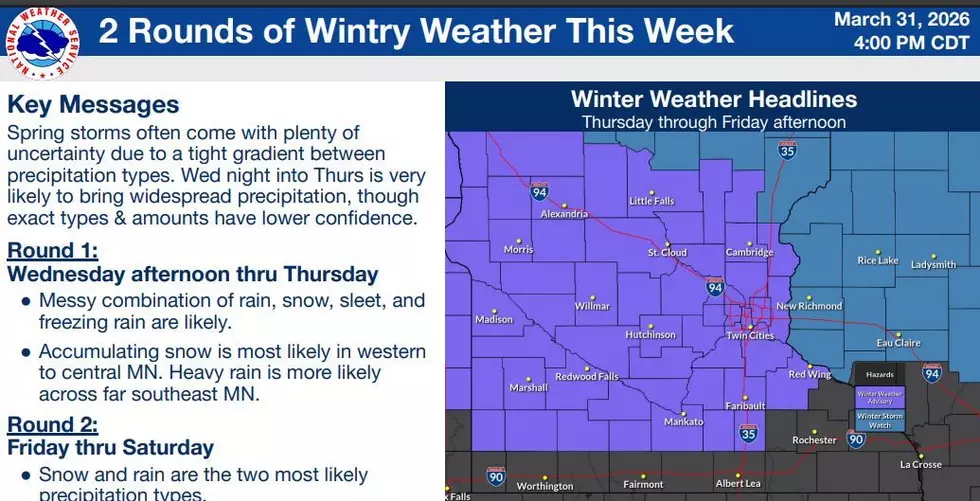
The National Weather Service has issued a Winter Storm Watch for parts of northern and northeastern Minnesota. It will be in effect from Wednesday evening through late Thursday night.
Heavy snow is possible. Total snow accumulations between 4 and 7 inches are possible. Closer to Duluth and the North Shore, total snow and sleet accumulations between 4 and 9 inches except between 7 and 10 inches for the higher terrain of the North Shore, and ice accumulations of around one-tenth of an inch are possible. Winds could gust as high as 35 mph.
A Winter Weather Advisory has been issued for western and central Minnesota. It will be in effect from 1:00 p.m. on Wednesday through 7:00 p.m. on Thursday. Stearns, Benton, and Sherburne Counties are included in the advisory area, which extends down to the Mankato area.
Mixed precipitation is expected. Total snow accumulations between 3 and 5 inches, sleet accumulations around three-quarters of an inch, and ice accumulations around one-tenth of an inch.
Another wintry system looks possible to end the week on Saturday.
St. Cloud has officially had 38.3 inches of snow so far this season, which is 4.6 inches below normal.
These Photos of '80s Office Life Will Take You Back
Gallery Credit: Stephen Lenz
More From AM 1240 WJON