Another Big Spring Storm Possible for Minnesota Next Week
UNDATED (WJON News) -- As many Minnesotans dig out from this week's big snowstorm, forecasters are looking ahead to another possible powerhouse storm before St. Patrick's Day weekend.
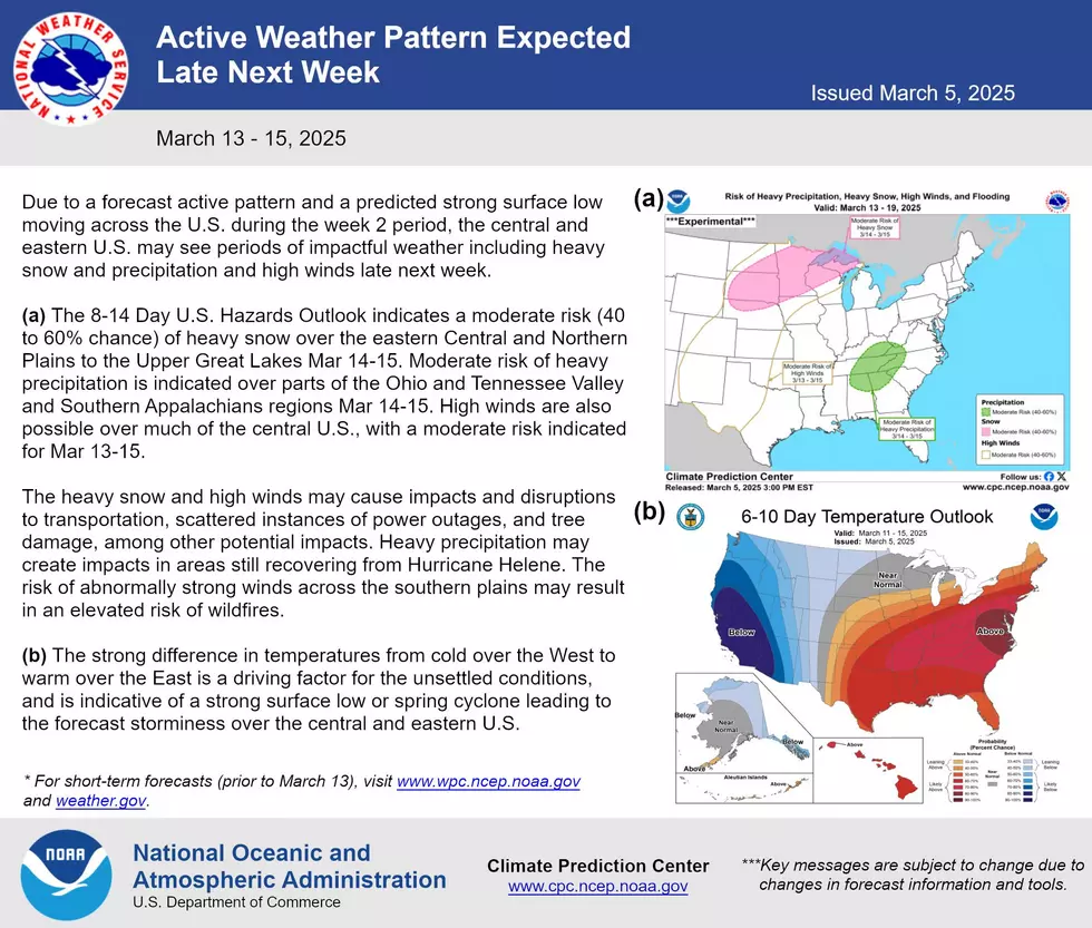
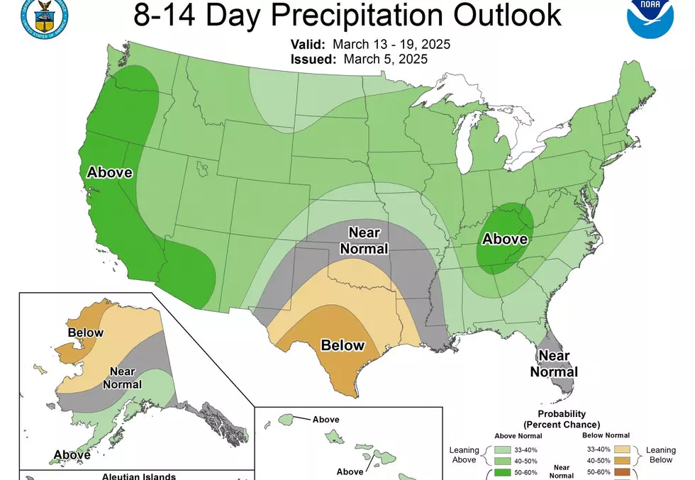
Longer-range model guidance is pointing towards the next larger winter storm system to move into the Upper Midwest from March 14 - 15 (next Friday through Saturday).

There is large uncertainties in the track of this system though as to whether it brings most precipitation to the Dakotas or even parts of the Northland.
The general track though does favor more mixed precipitation and wet, heavy snowfall as compared to most clippers that have been observed this winter. There is 40-60% confidence for moderate to maybe heavy snowfall in the Upper Midwest, including the Northland, during this March 14-15 time period.
The National Weather Service says it's a long way out, but there is considerable agreement that another powerhouse low-pressure system will track through the Plains late next week.
For now, we'll enjoy a stretch of quieter weather.
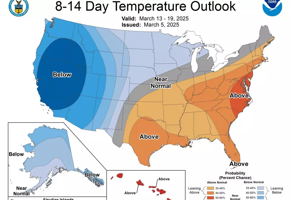
We’ll remain dry with temperatures gradually warming into the 50s & 60s by early next week.

A heads up that we make a jump to Daylight Saving Time Saturday night & lose an hour of sleep.
READ RELATED ARTICLES
- Huskies Win 9th Straight Super Region V Championship
- Main Street Grant to Benefit Downtown St. Cloud, Foley
- St. Cloud's Kyle Backer Named Minnesota Trooper of the Year
- 6 St. Cloud Area Young Professionals Chosen for 2025 Cohort
- Trump Tariffs Could Impact Your Local Brewery's Bottom Line
LOOK: These Foods Look Nothing Like You'd Expect Before They're Harvested
Gallery Credit: Stephen Lenz
More From AM 1240 WJON