

Get Ready For A Stormy Tuesday Across Minnesota
UNDATED (WJON News) -- Expect showers and thunderstorms on Tuesday. A few could be strong to severe in central and north-central Minnesota.
The primary hazard if severe storms do form would be hail up to the size of ping pong balls (1.5 inches in diameter).

The secondary hazards would be wind gusts up to 60 mph and locally heavy rainfall.
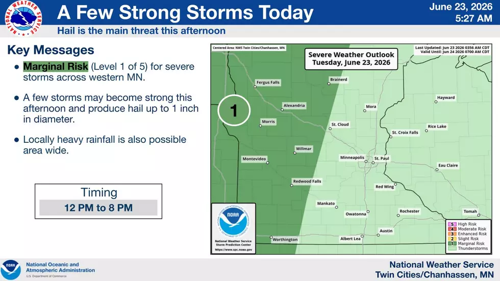
Best chances for rain and any strong to severe storms will be in the afternoon and evening.
The pattern will undergo a transition to hotter and more humid conditions next week. Highs may reach the 90s. With dew points in the 70s, it'll feel closer to 100. These conditions may continue through early July.
As the transition occurs, multiple rounds of thunderstorms are possible this weekend into next week.
St. Cloud has officially received 2.19 inches of rain in June, which is just over a half inch below normal.
The latest update from the U.S. Drought Monitor shows 77 percent of the state is abnormally dry, 38 percent is in a moderate drought, and 13 percent is in a severe drought.
Brantley Gilbert 2026
Gallery Credit: Paul Habstritt
More From AM 1240 WJON