

Two Rounds Of Severe Storms Are Headed For Minnesota
UNDATED (WJON News) -- A line of thunderstorms will move across Minnesota into western Wisconsin on Wednesday morning.
Brief heavy downpours and gusty winds are expected.

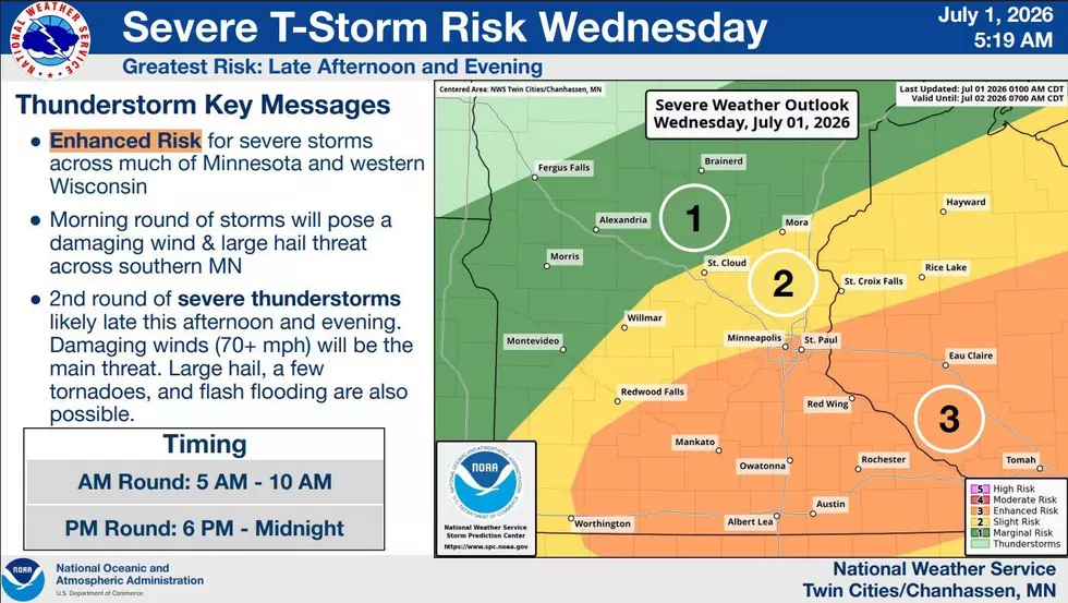
A second round of thunderstorms is expected on Wednesday afternoon and evening, primarily across southern Minnesota and western Wisconsin. All modes of severe weather are possible with these storms, including large hail, damaging wind gusts, and a few tornadoes.
A higher risk of heavy rain and flooding also exists with these slower-moving storms.

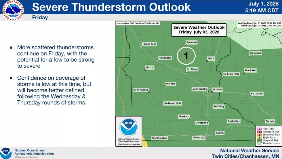
Additionally, storm chances continue daily through the weekend, along with warm and muggy conditions.
In June, St. Cloud officially received 3.62 inches of rain, which was slightly above normal.
The latest update from the U.S. Drought Monitor says that as of last Thursday, 77 percent of the state is abnormally dry, 41 percent is in a moderate drought, and 14 percent is in a severe drought. Central Minnesota is one of the few areas in the state that has had adequate moisture so far this year.
Stunning NASA Photos From The Artemis II Lunar Flyby 2026
Gallery Credit: Kelly Cordes/TSM/St CLoud
More From AM 1240 WJON