

A Cold Front Hits Western Minnesota Monday Night With Severe Storm Risk
UNDATED (WJON News) -- Another gorgeous day is on tap!
Monday will be mostly dry with southerly winds gusting 20-25 miles an hour.

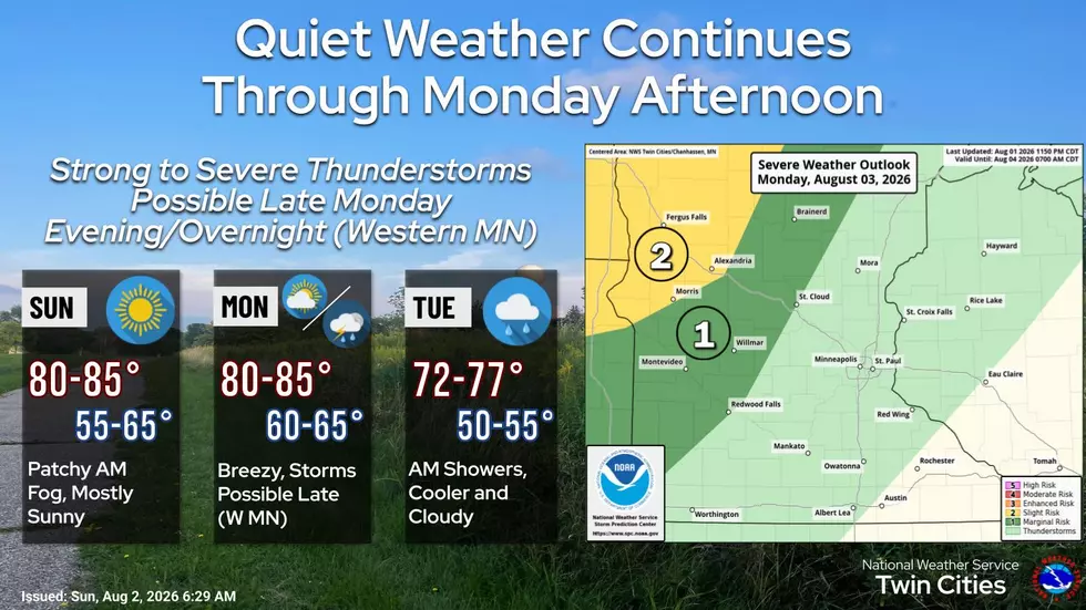
A cold front will move through Monday evening into Tuesday morning, bringing showers and storms. Some storms across western Minnesota may be strong to severe.
Looking back at the weather in July
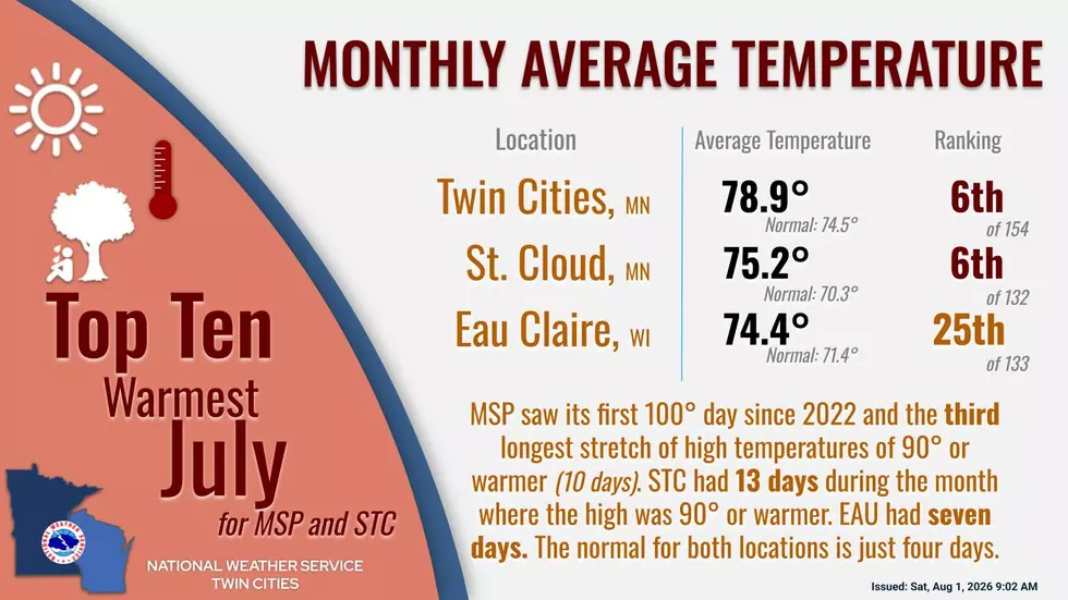
MSP saw its first 100° day since 2022 and the third longest stretch of high temperatures of 90° or warmer (10 days). STC had 13 days during the month where the high was 90° or warmer. EAU had seven days. The normal for both locations is just four days.
July 31st’s record rainfall at MSP (1.53”) accounted for nearly half of July’s total rainfall. St. Cloud’s monthly precipitation summary includes a trace of snowfall from hail that fell on July 4th.
St. Cloud has had 6.44 inches of rain so far during the summer months of June, July and August combined, which is about an inch below normal.
Check out the painted murals of Downtown St. Cloud
Gallery Credit: Jim Maurice, Townsquare Media St. Cloud
More From AM 1240 WJON