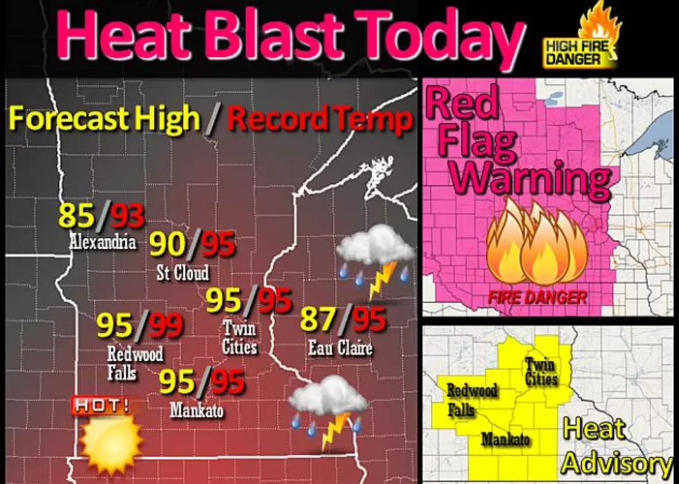
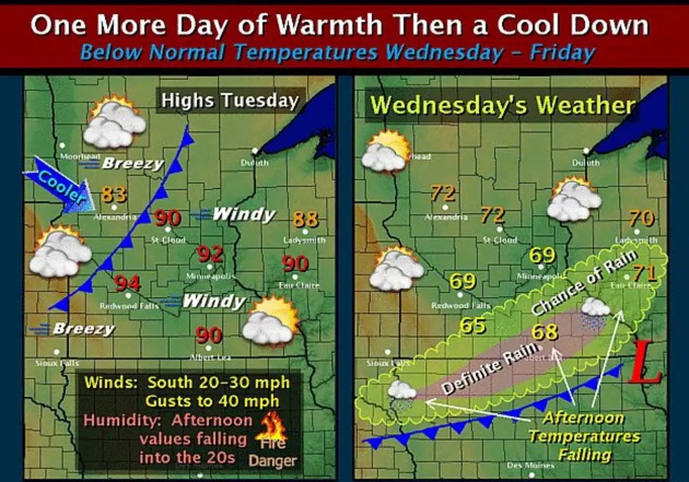
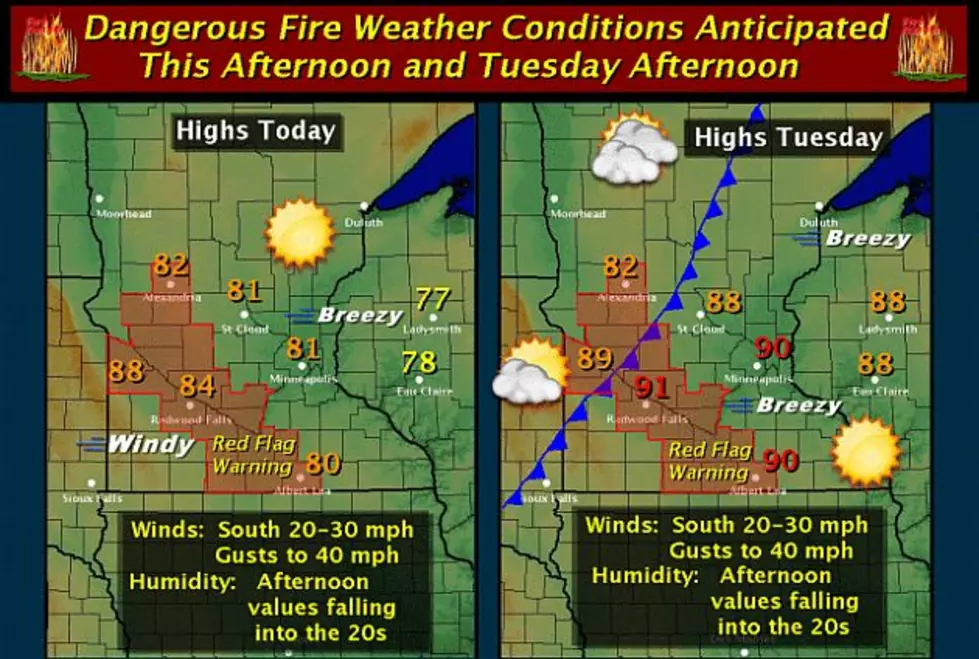
Central Minnesota Under Red Flag Warning & Fire Weather Watch
UNDATED (WJON News) -- The Tri-County area is under a Red Flag Warning and Fire Weather watch until Monday night due to the dry conditions. The National Weather Service has issued a Red Flag Warning from 11:00 a.m. Sunday morning until 10:00 p.m. Sunday night for much of Central Minnesota due to the gusty winds and low relative humidity in the region.


A Red Flag Warning is issued when the combination of dry conditions supports extreme fire danger. Central Minnesota is also under a Fire Weather Watch from Monday afternoon until Monday evening with winds expected out of the south, southwest from 15 to 35 miles per hour and humidity as low as 15 percent. People should avoid burning, be careful around open flames, and safely dispose of cigarettes because fire can spark and grow very quickly in the dry conditions.

The National Weather Service says the warning and watch could be extended if the dry conditions continue into Tuesday. Area counties included in the Red Flag Warning and Fire Weather Watch include Stearns, Benton, Sherburne, Morrison, Todd, Kandiyohi, Meeker, Wright, Douglas, Mille Lacs, Stevens, Pope, Lac Qui Parle, Swift, Chippewa, Yellow Medicine, Renville, McLeod, Sibley, Carver, Redwood, Brown, Nicollet, Watonwan, Blue Earth, and Martin.
READ MORE FROM AUTHOR PAUL HABSTRITT:
- Animals Come to Earth In Latest From Inside Up Games
- Red Carpet To Celebrate Anniversary With Big Event This Fall
- New Family Achievement Center’s Mission Is To Provide Hope
- Pine Grove Zoo Ready For A Big 2025 Season
- New Speed Limit For Farm Equipment On Minnesota Roads
- Vinyl Fans Gearing Up For A Holiday-Like Weekend
See the Aftermath of the 1886 St. Cloud, Sauk Rapids and Rice Tornado
Gallery Credit: Brown and Riley, "Cyclone Views: Pictures Sauk Rapids Cyclone" (1886). University and Other Publications. 1.
Central Minnesota Storm Photos from May 12th, 2022
Come Visit Big Lake in Pictures
More From AM 1240 WJON