Blizzard Conditions Looking Likely in MN Days Before Christmas
UNDATED (WJON News) -- A potentially dangerous week of weather is ahead.
The National Weather Service says multiple hazards are expected this week.
A Special Weather Statement has been issued by the National Weather Service for central and southern Minnesota for Monday.
Light snow is quickly developing across southern Minnesota and spreading northeast. It will engulf all of central and southern Minnesota and west central Wisconsin by Monday afternoon. Accumulations of 2 to 3 inches are expected, with the highest totals from south central and east central Minnesota to northwest Wisconsin.
Significant impacts to the evening commute are possible, so slow down and give yourself plenty of time to reach your destination.
Several inches of fluffy snow will come on Wednesday and Wednesday evening. Travel impacts are likely, but winds will remain light so no blowing snow.
A Winter Storm Watch has been issued for much of the state from Wednesday morning through late Friday night. Five to 10 inches of snow is possible.
Temperatures will be very cold in the single digits above and below zero.
Winds will begin increasing late Wednesday night and Thursday as light snow continues. By Thursday, wind gusts of 40-50 mph appear likely.
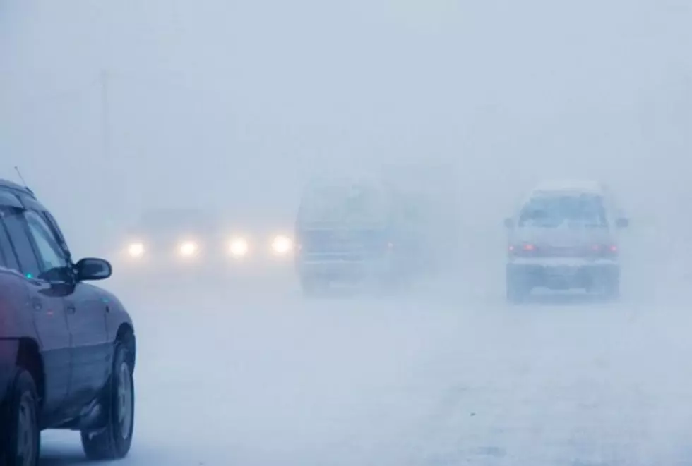
Blizzard conditions are highly likely, even in areas that typically aren't favored for whiteout conditions, including the metro and western Wisconsin.
A Wind Chill Watch will be in effect from Thursday evening through Saturday morning.
Wind chills will dive to dangerous levels (30 to 45 below zero) as the wind increases Thursday, which will threaten your life if you get stranded while traveling.

The blizzard conditions (light snow, strong winds, blowing snow) could last into Friday night, impacting travel potentially into Saturday.
With snow still stuck on trees, the strong winds may cause power outages while temperatures are below zero.
FEMA Statement on the pending winter storm:
FEMA encourages everyone to prepare now: if necessary, alter travel plans, remain indoors and follow the instructions of local and state officials to stay safe.
Be sure to check forecasts for your area and any areas you’re traveling through or to.
- If you must be on the road during severe winter weather, take precautions to get to your destination safely. Make sure you have a full tank of gas and essentials on hand before you leave—including a flashlight, warm clothes, blankets, food and water. Have those extra essentials for air or rail travel too.
- If you’re trapped in your car, stay inside. Watch for signs of frostbite and hypothermia.
- Make sure everyone knows who to call if travel will be delayed or postponed.
If you’re staying home for the holidays, take steps to stay safe there too:
- Prepare for possible power outages by ensuring electronics are fully charged.
- Gather supplies in case you need to stay home for several days without power. Keep in mind each person’s specific needs, including medication. Do not forget the needs of pets. Have extra batteries for radios and flashlights.
- Check on your neighbors or friends. Older adults and young children are more at risk in extreme cold.
LOOK: 15 Unconventional Christmas Albums From the Past 50 Years
More From AM 1240 WJON