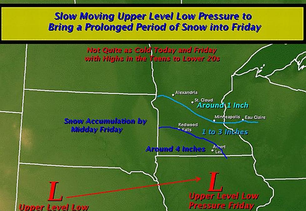
An upper level low pressure will slowly move east across Nebraska today and tonight reaching northern Iowa around midday Friday. This will bring a lengthy period of snow across much of our region.
Over the next 24 to 36 hours, our weather will become very active with numerous showers and thunderstorms developing, then transitioning to snow and rain.
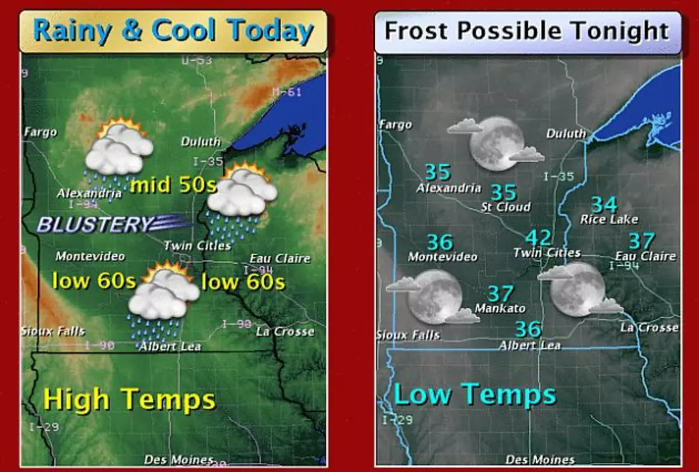
A large storm system is expected to bring much needed rainfall across the Upper Midwest over the next few days, along with strong winds. A cold front will march eastward across the area today bringing west winds gusting to 30 to 40 mph across parts of west central into southwest Minnesota .
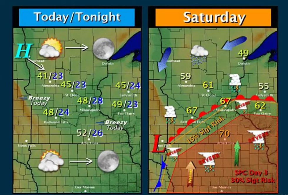
Late tonight and Saturday, a low pressure system will develop over the Plains and track east toward Iowa. This will bring an increasing threat of showers and storms to about the southern third of the Minnesota and western Wisconsin.
A vigorous low pressure system will move northeast from the central plains this weekend. Widespread showers and thunderstorms will spread into central and southern Minnesota and west central Wisconsin by Saturday morning and continue through Saturday night.
In the wake of Thursday's cold front, the cold air is here to stay through the weekend. Highs today through Sunday will be in the 40s and 50s with lows in the 20s and 30s, both in the neighborhood of 20 degrees below normal.
A powerful cold front will move across the area on Wednesday into Thursday, and bring a chance of showers. A push of colder air will follow the front, with Thursday's temperatures 20 to 25 degrees cooler than they have been.
The National Weather Service says A line of thunderstorms are expected to develop across northwestern Minnesota and move across the state this (Wednesday) afternoon.
The month of October has been a warm one. Eight of the nine days so far this month have had a high of 78-degrees, or higher. Five of those days have been in the 80s.