Rain will mix with and change to snow over the rest of the area during the evening. Accumulations could reach around thee inches north of a line from St. Cloud to Cambridge, with lesser amounts elsewhere.
A reminder that you'll be hearing the warning sirens today (Thursday). Emergency Management officials will be sounding the sirens at 1:45 p.m. this afternoon and again at 6:55 p.m. tonight.
Rough weather moved across Minnesota and Wisconsin on Sunday afternoon and evening, damaging homes, barns, power lines and trees. Three barns were blown down and a mobile home was knocked off its foundation by high winds in Houston County of far southeastern Minnesota.
Today marks the beginning of Severe Weather Awareness Week. From April 11-15, the State of Minnesota and the National Weather service encourage you to brush up on how to handle extreme weather.
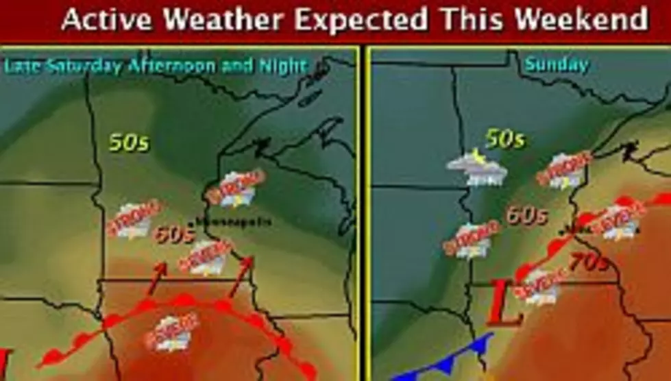
The National Weather Service says there is a slight risk of severe thunderstorms late Saturday afternoon and Saturday night in south central and east central Minnesota. There's also a slight risk off severe thunderstorms across much of Minnesota Sunday and Sunday night.
The Sauk River is flowing over it's banks, but so far Anton's Restaurant has not been affected. Owner Patti Gaetz says, even though they have water in part of their parking lot, the restaurant is open and is staying dry.
The National Weather Service is predicting the Sauk River in St. Cloud will rise above flood stage sometime early tomorrow (Wednesday) morning. The flood stage is six-feet.
The March weather summary from St. Cloud State University says St. Cloud's average temperature last month was 24.3 degrees -- about four-degrees colder than normal. It was our coldest March since 2002.