This Lake Mille Lacs Resort Just Shared Some Unbelievable Pictures
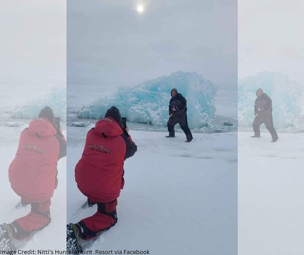
It's been a challenging winter for resort owners across Minnesota. Some resort owners are hoping to rebound with the upcoming cold snap, where parts of Minnesota will see low temperatures in the teens below zero creating new ice across Minnesota's many lakes. One Lake Mille Lacs Resort just shared some photos from out on the lake, and now I've got questions. What is that big iceberg-looking thing, and how did that form out on the lake?
Nitti's Hunters Point Resort posted the intriguing photos to their social media page yesterday evening. The pictures show a giant ice mass sticking out of the lake ice seemingly standing more than 5 feet high.
Guys are out and about checking around and this is some of the things they are finding out there!
I don't think I've ever seen something like this before in a lake. But the University of Minnesota might have an idea on what this giant mass of ice is.
Under turbulent conditions, ice freezes in a less orderly and transparent way than in calm water conditions. In turbulent conditions, initial ice formation is due to the formation of what is called frazil ice or fine ice crystals suspended in the water. Frazil clumps together quite easily and forms a sort of slush at the water’s surface and can pile up and accumulate when pushed by wind or currents. When the slush clumps together it forms “sludge ice”
So maybe what we are seeing in these pictures is a collection of sludge ice that was blown around by the wind, and froze together in this impressive structure.

If you are heading out this weekend onto the 'hard' water, make sure you keep an eye on the weather forecasts and measure as you head out. Many area lakes are just getting back to having 3-5" of good ice again after all the warm weather we had in December.
Come Visit Farming, MN With Us in Pictures
KEEP READING: Get answers to 51 of the most frequently asked weather questions...
LOOK: The most extreme temperatures in the history of every state
Gallery Credit: Anuradha Varanasi
More From AM 1240 WJON