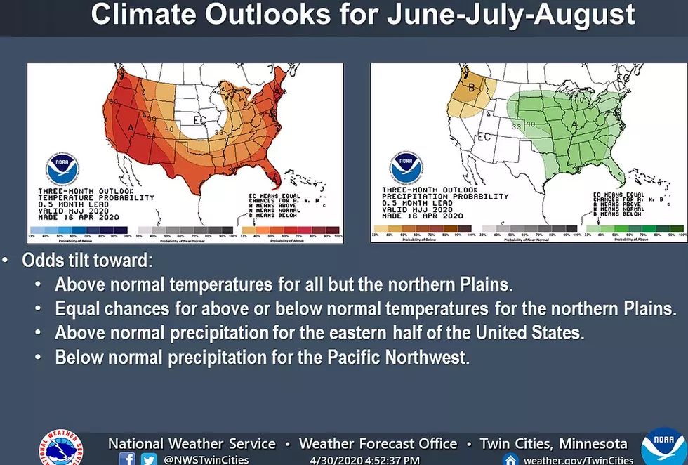
Our 3-month summer outlooks from the Climate Prediction Center show Minnesota and western Wisconsin in equal chances for above or below normal temperatures, and better odds for above-normal precipitation.
The National Weather Service has issued a Fire Weather Watch on Monday. The watch area includes near and south of a line from Morris to Alexandria, Little Falls, and Mora.
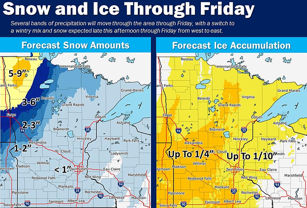
Rain will work into the southern part of the area Saturday night, then mix with and eventually change to snow as it spreads northeast across most of the area on Sunday.
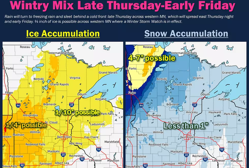
Rain will turn to freezing rain and sleet behind a cold front Thursday evening across western Minnesota. This transition will push east Thursday night, reaching I-35 around dawn Friday.
Rain will turn to freezing rain and sleet behind a cold front late Thursday across western Minnesota, which will spread east Thursday night and early Friday.