Some unseasonably cold weather is moving into Minnesota. The National Weather Service has issued a Freeze Watch and Frost Advisory for parts of the state, mainly north of a line from Brainerd to Fergus Falls.
Storms are expected Saturday night, and a few could produce large hail or damaging wind across the southern half of Minnesota into northern Iowa and western Wisconsin.
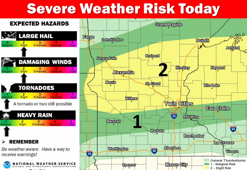
Severe thunderstorms are possible Thursday evening through the night, with the best chances along and south of a line from Montevideo MN to the southern Twin Cities metro to Eau Claire Wisconsin.
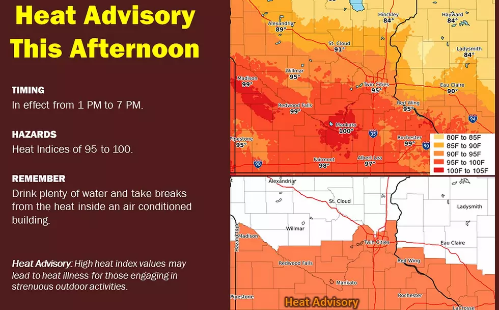
High temperatures today will climb into the upper 80s to low 90s south of the I-94 corridor, which will result in afternoon heat index values near 100 degrees.