A round of strong thunderstorms moved through the area overnight. There were thunderstorm warnings for Stearns, Benton, Morrison and Todd counties, and a tornado warning for Sherburne county.
More thunderstorms rumbled through Central Minnesota overnight and early this (Thursday) morning. A line of storms moved through parts of Todd, Morrison and Benton counties dropping golf ball size hail.
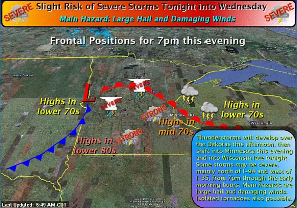
Thunderstorms are expected to develop late this (Tuesday) afternoon over central Minnesota, then gradually move east. There is a slight risk of severe thunderstorms, with the primary hazards being large hail and damaging winds, along with a secondary threat of isolated tornadoes.
Storms sweeping across central and southern Minnesota have dumped heavy rain and hail but caused no major damage. The National Weather Service says two tornadoes were spotted Sunday in McLeod County and another twister was seen in Lyon County. But those counties report no damage or injuries.uthern Minnesota have dumped heavy rain and hail but caused no major damage.
Thunderstorms will begin to develop later this (Monday) afternoon across Western Minnesota. These storms will move across Central and Eastern Minnesota during the evening. Some stronger storms may produce small hail and gusty winds.
There was an impressive lightening display in the skies over the St. Cloud area this (Monday) morning as thunderstorms rumbled through. Steven Sohlstrom from FlightFlash.com caught a few of the flashes on video:
The National Weather Service says non-severe thunderstorms are expected over the region tonight (Friday) into Saturday morning. Heavy rainfall and gusty winds will be possible.