A Wet Weather Pattern Will Stay With Us for a While
UNDATED - We had some severe thunderstorm warnings in central Minnesota this (Thursday) morning. Mostly some stronger winds and quarter size hail being reported. Nearly 1 1/2 inches of rain fell with the morning showers.
Another round of stronger storms are possible this afternoon and evening.
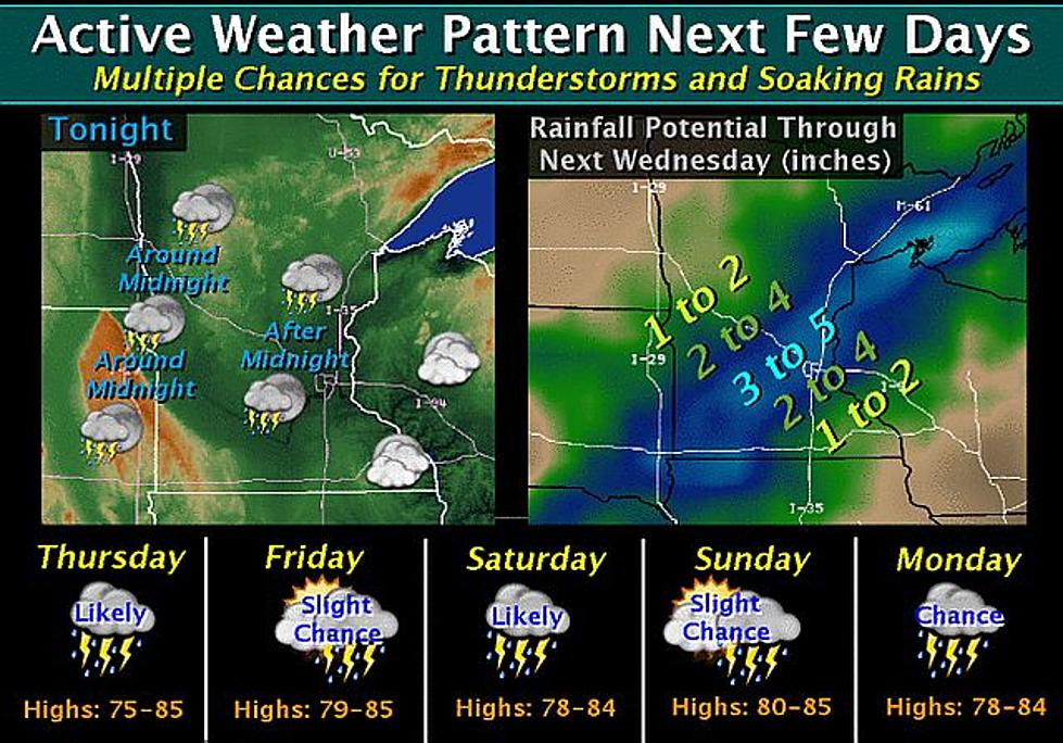
Looking ahead, a frontal boundary will stall out across the region and several thunderstorm complexes will track along this boundary over the next few days. Depending on the exact location of these complexes, the total rainfall potential from these storms over the entire 7-day period may exceed 3 to 5 inches. A few locations could potentially see over 5 inches.
More From AM 1240 WJON