NWS: Colder Temps Here, Snow To Our North
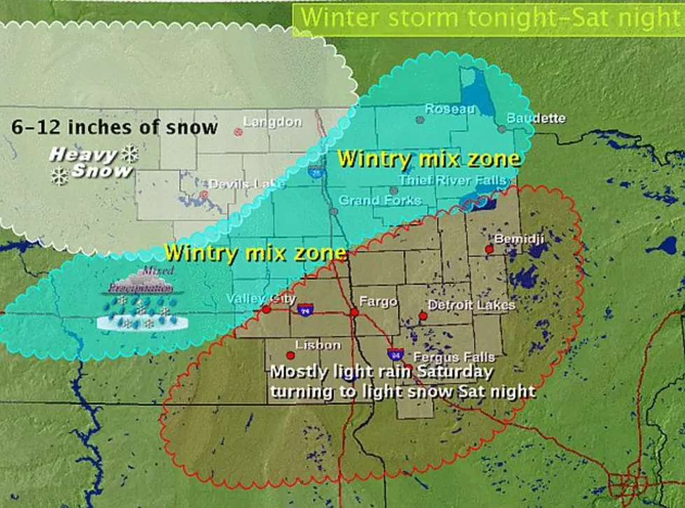
UNDATED - Forecast conditions shown on this map may change so keep tuned for further updates. Low pressure will organize in Nebraska and move into west central Minnesota Saturday evening and then to north central Minnesota early Sunday.
Snow will spread into the Devils Lake basin and and points east and northeast from there into Manitoba tonight and continue into Saturday night with heavy snow likely. Temperature profiles indicate a mix of light freezing rain...sleet....snow and possibly even plain rain for a time to develop late tonight and continue into Saturday before changing to all snow Saturday night in a region from Lake of the Woods through Grand Forks to Valley City and Jamestown.
Further south generally light rain and drizzle will fall late tonight into Saturday turning to light snow Saturday night. Colder air and some light snow will occur on Sunday into Sunday night.
Cold weather expected early next week with some moderation by mid week.
More From AM 1240 WJON